🛠️ Union
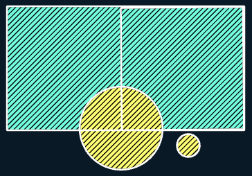
Purpose: > In Union, the output layer consists of all the features that occur in any one of the inputs or in all of them as well as the features that formed due to the overlapping of the features between input layers along with all their attributes and spatial extents. Simply, It preserves all features and make new ones for the overlaps.
🎭 Illustration

📋 Technical Specifications
| Requirement | Detail |
|---|---|
| Input Feature Types | Polygon |
| Output Feature Type | Polygon |
| Map Name | 01.Union |
| inputs GDB | 01.input_union.geodatabase |
| output GDB | 01.output_union.geodatabase |
🧠 Logic & Arithmetic Operation
Logic: Or / Addition
⚙️ Parameters & Conditions
Input Parameter: Input Features
Overlay Parameter: None
Geometry: Polygon only
No. of Inputs: One or more
Order: Doesn’t matter $A \cup B = B \cup A$
Coordinate System: Same as 1st input layer
🐍 Arcpy Function
arcpy.analysis.Union(in_features, out_feature_class, {join_attributes}, {cluster_tolerance}, {gaps})
for more on function parameters, check: Arcpy Documentation Here.
🖼️ Figures
| Input A | Input B | Result |
|---|---|---|
 |  |  |